


Saltwater filled my nose and mouth, stinging my eyes and throat. “What a weird dream,” I thought before the world righted and I gulped in fresh sea air. Exhausted, dehydrated, sick and very lost, I had fallen asleep in my cockpit and woken up when a wave tossed me in the rough seas. My predicament was the result of poor navigation. On a multi-day expedition along the Georgia coast, I didn’t plot my course and I ended up completely lost.

Battery-Free Coastal Navigation for Dummies

Nautical navigation skills fill volumes, but two simple techniques will keep a paddle-powered angler on course without relying on a handheld GPS. Terrain association is matching landforms depicted on a nautical chart to what is seen by the paddler. Dead reckoning is keeping track of speed over time to approximate the paddler’s position. With few landmarks and constant exposure to the elements, finding your way along open coastline can be especially challenging.
A paddler who knows the distance to a destination and his speed of travel can predict his arrival time and find his location on the chart. In nautical terms, distance is measured in nautical miles. A kayak fisherman paddling a sit-on-top averages about two nautical miles per hour, or two knots. By using an accurate nautical chart and a waterproof watch, an angler can track his position and chart his course.
Last year on the Georgia coast, I failed to establish checkpoints along my route. Paddling through strong current and relentless headwinds on a coastline with few distinguishing features made accurate navigation even more important. The next day I added more checkpoints to our plan and we stayed on course the rest of the trip.
Coastal Navigation Techniques
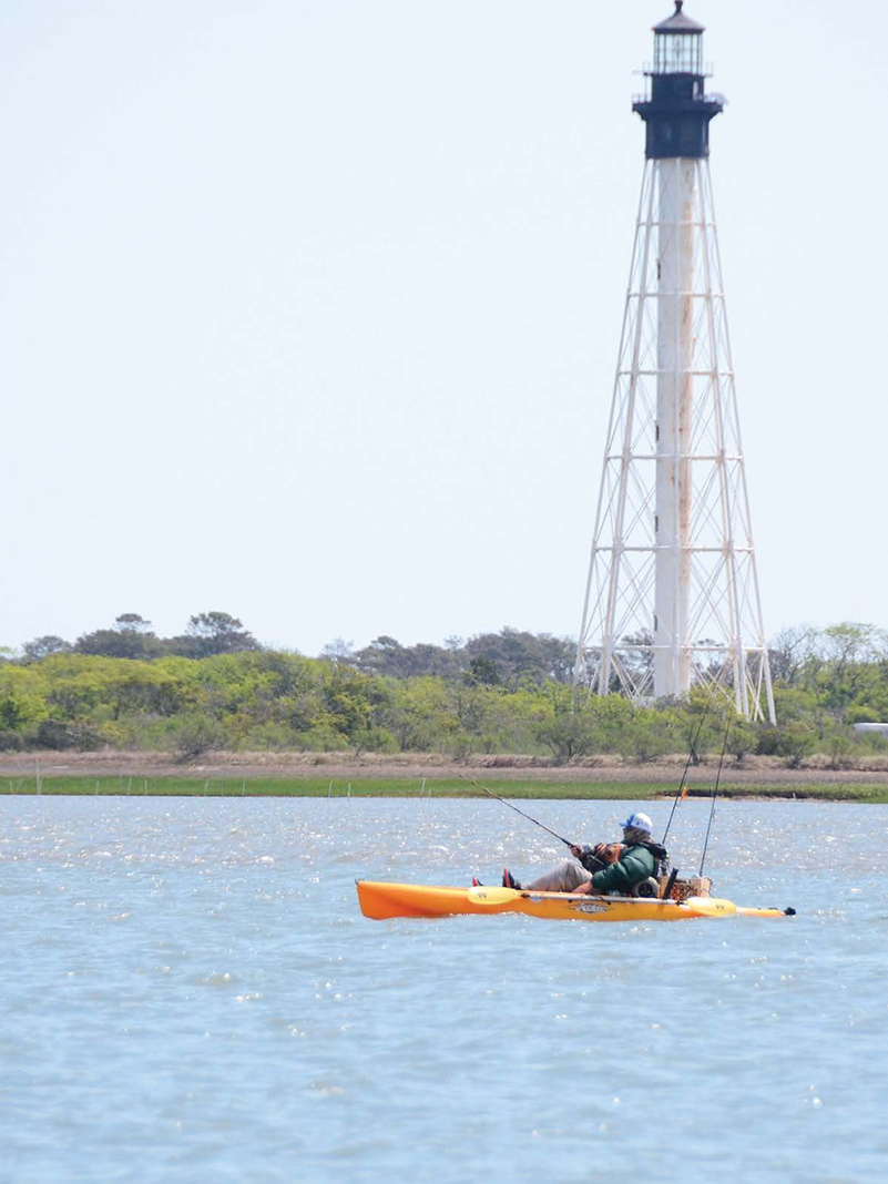
- Find your location on the chart. Starting at a known location such as a boat ramp or lighthouse will make this easier.
- Identify your destination on the chart.
- Select a few easily identifiable landmarks along the route, such as hilltops or towers, to use as checkpoints.
- Using the chart’s scale and a ruler, measure the distance in nautical miles between your current location and the checkpoint. Then measure between the checkpoint and your destination.
- Estimate speed at two knots and plan to travel one nautical mile in 30 minutes.
- Note the time on your watch when you depart and again when you reach the first checkpoint.
- Adjust estimated speed and calculate progress accordingly.
- Each checkpoint allows the paddler to confirm his location and ensure he is on course. This technique can be used to find a campsite, sheltered cove or fishing spot.
Henry Jackson guides fly fishing trips and instructs paddling courses.

Using landmarks such as a lighthouse, tower or geographic feature, a paddler can find his location on a chart and monitor his progress along the coast. | Feature photo: Ric Burnley


